By Rebecca Onion
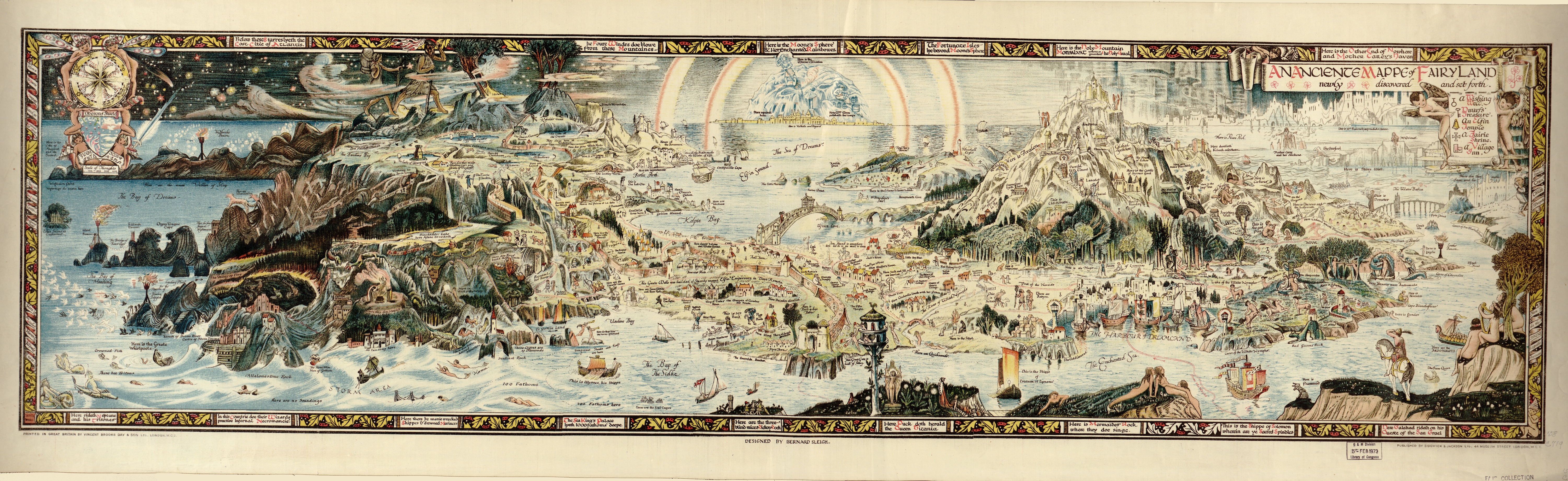
Bernard Sleigh's 1918 map of a place he called "Fairyland" mashes up dozens of stories to make a comprehensive geography of make-believe: Rapunzel's tower, cheek by jowl with Belle's palace from "Beauty and the Beast"; Humpty Dumpty on a roof, overlooking Red Riding Hood's house; Ulysses' ship, sailing past Goblin Land.
In their book A History of the Twentieth Century in 100 Maps, Tim Bryars and Tom Harper comment that, given its publication date, this map makes for a striking juxtaposition with everyday life. "Compared with the devastated, bomb-blasted landscape of northern France, this vision of a make-believe land may have seemed a seductive escape for a European society bearing the psychological and physical scars of mass conflict," they write. Any small amount of violence or trauma you might find in "Fairyland" could be easily evaded by moving on to the next area of the map, where a new set of stories unfolds.
In 1926, writes Douglas A. Anderson in Fantasy & Science Fiction, Sleigh, this map's designer, wrote a book about fairies titled The Gates of Horn: Being Sundry Records from the Proceedings of the Society for the Investigation of Fairy Fact and Fallacy. Though later critics thought Sleigh's book satirized Sir Arthur Conan Doyle's recent public advocacy for the existence of fairies, Anderson writes, Sleigh was, in actuality, a true believer: "He entirely sided with Doyle."
Definitely click on the image below to zoom in and see details! Or, visit the map's page on the Library of Congress' website.
Library of Congress
No comments:
Post a Comment